An icon in the making
The Tyndall Range and its surrounds, located 30 minutes north of Queenstown, has been selected by the Tasmanian government for development as the state’s next “iconic walk”. Since the walk was first announced in 2019, it has been hugely controversial with environmental groups and local bushwalkers questioning the selection process and the walk’s impact on the Tyndalls’s sensitive alpine environments. Now, the final route has been tweaked and released to the public in a series of information sessions held around the state this month, with public viewings of the plan finishing up in Hobart last week.
On display were the walk route, artists impressions of the infrastructure and, preliminary interpretation notes. Also present at the information sessions were several staff from Tasmania’s Parks and Wildlife Service (PWS) as well as private contractors. All of them brave enough to face the polite but possibly hostile bushwalking community. Which included me.
Having first walked Mt Tyndall in 2015 I have followed the recent developments and revelations of this new “iconic walk” with interest. We published a blog on it in 2020 when the first proposed route roamed across the exposed and sensitive Tyndall plateau, a place that has never seen fire and is covered with ancient alpine vegetation including pencil pines, swathes of fagus and King Billy pines. The now finalised trail has changed a lot since then and, despite continued criticism and local opposition, construction is due to start in 2025.
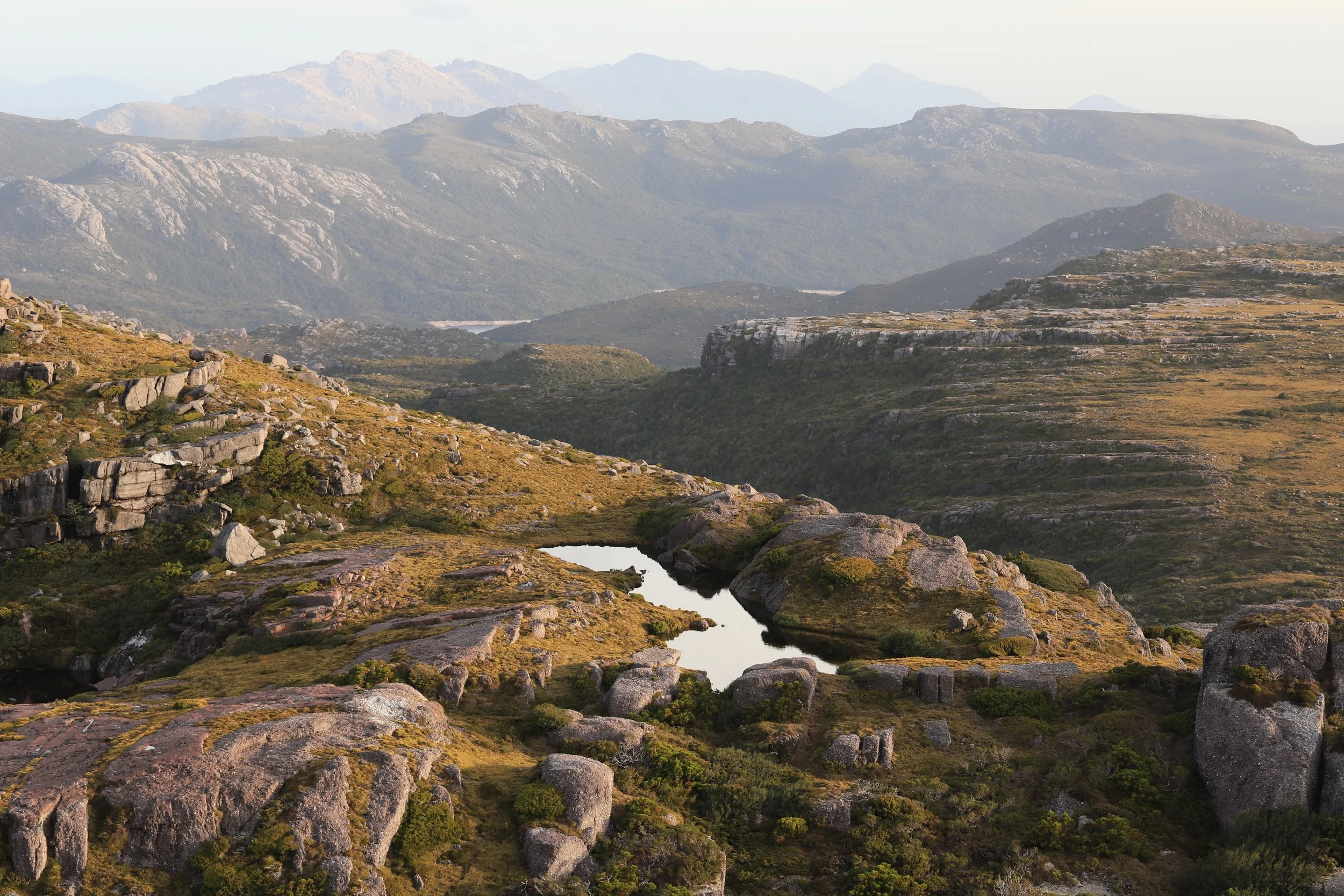
The final track route now, at least, stays off the Tyndall plateau and instead skirts its eastern fall, taking in numerous lakes, scenic high points and views to some of Australia’s highest cliffs (around Lake Huntley) and the classic glaciated landscape that makes up the area. The new development includes two hut sites, each with a bunkhouse as well as stand-alone, personal accommodation pods. There will be one camp site. There will be lookouts, day shelters and a trailhead serviced by shuttle buses from Queenstown. The hut-based experience will involve walking 8km on the first day, 10km on the second and 10km on the third. The tent-based experience will be just two days, with 12km on the first day and 16km on the second day. A feasibility study released in 2021 revealed walkers should expect to pay $576 to stay in the huts and $288 to camp. A budget of $40 million dollars has been allocated to build the track, up from $20 million when first announced in 2019.
Back in 2015 we walked to Mt Tyndall and Lake Tyndall as a day walk. It was an April, autumn, the fagus had turned and every tarn and gully on the open plateau was a patchwork of gold. We returned for a two day walk on the plateau in 2020 and again in 2021 for an overnight, winter walk up its north west ridge. At present, access in the area is quite limited. There is just one rough, obscure walking track onto the plateau and a few faint pads in other parts. Historically, the Tyndalls has been a place rarely visited by, well, anyone but local walkers and climbers comfortable with off-track navigation. More recently it has gained attention from Abel baggers seeking Mt Tyndall, Mt Geike and not-so-nearby Mt Sedgwick. When we walked Mt Tyndall in 2020, we found the track narrow, rough, muddy and hemmed in by admirably persistent Tasmanian ti-trees and banksia, about 2-3m high; thin trunked and inflexible. Once we pushed through this scrub we climbed higher through low heath and then crested the range where the track largely petered out.
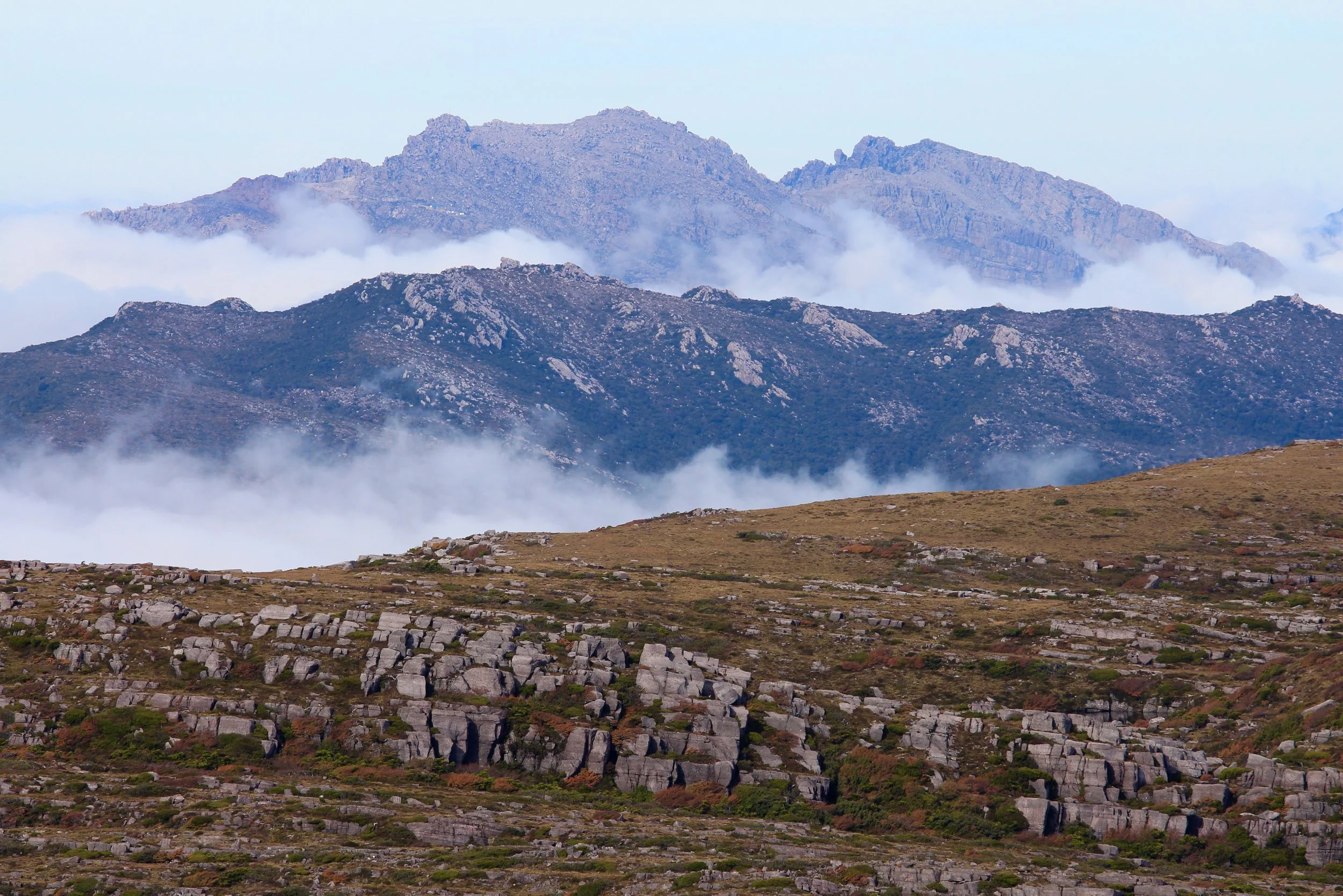
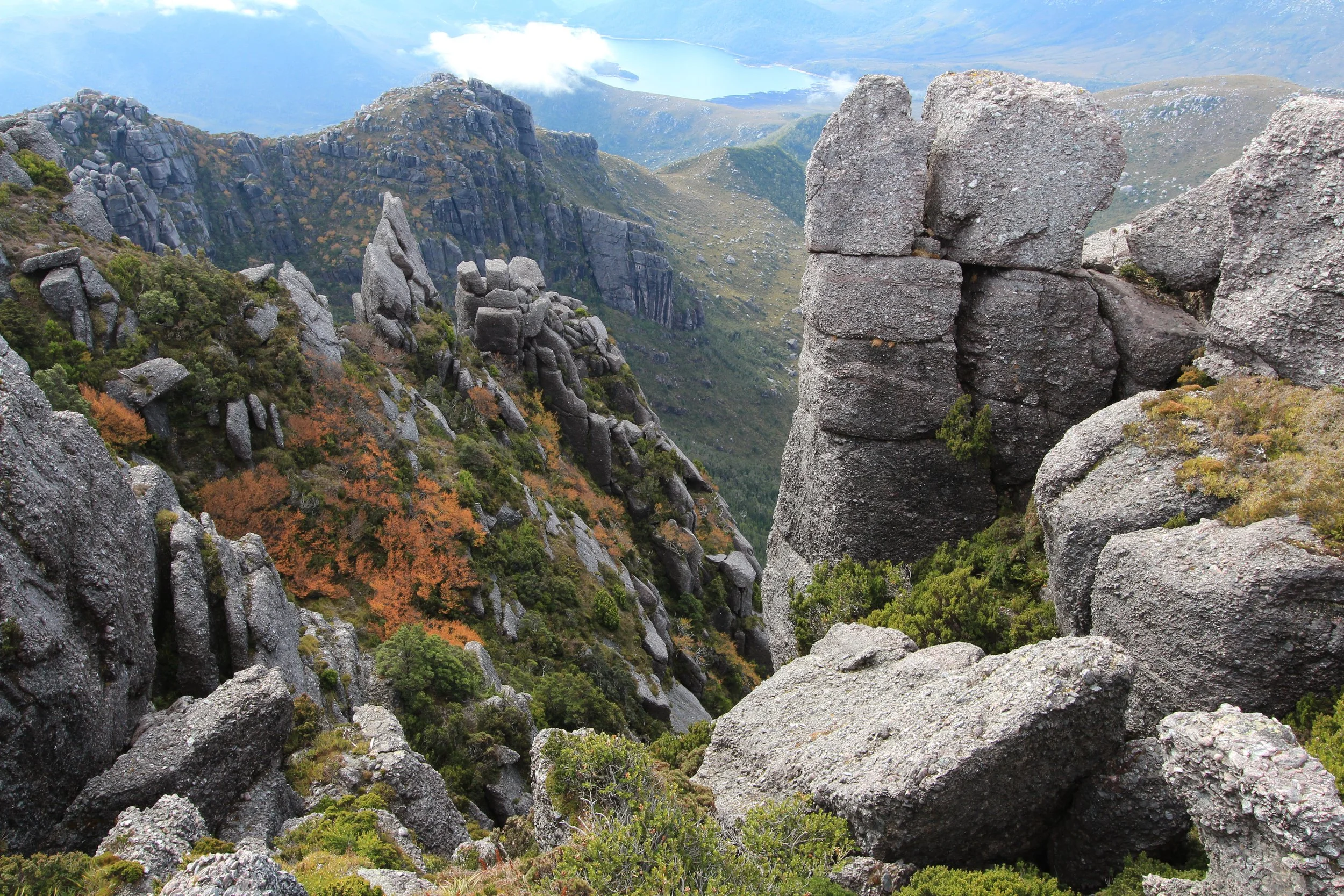
As we crested the range, and the tracks disappeared, I remember being met with a surprising sense of the mystical. It felt as if we had walked into an enchantment. The high, untouched plateau, elevated and isolated from the valley floors below, was like a land floating above the world. We cut southwards to the spectacular cliffs of the mountain cirque. The blueness of the distant Lake Tyndall to the west, backed by Mt Geikie; weird conglomerate rocks surrounded us. At Mt Tyndall's curved lip of a cliff line, the land drops nearly 300m to the Glacier Valley which lies below. North from the mountains edge I could see the rugged outline of Mt Murchison. Beyond that, the entire north-eastern spread of the World-Heritage listed Cradle Mountain-Lake St Clair National Park including Cradle Mountain and Barn Bluff silhouetted against a clear sky. Tiny gnats swarmed in the air. A green rosella flew overhead and landed on a rock across the next gully where it pinged its lovely call; rang its pretty bell. Atop the vertiginous cliffs, sounds floated up from the deep valley below. One currawong, its voice ringing off the sheer walls of rock. The world seemed demarcated into lowlands and high. Down there in Glacier Valley is where the new track will now wend and weave.
Many locals argue that Mt Tyndall, with its abundance of lakes and cliffs, is the state’s finest alpine region, boasting relatively easy access and few crowds. And while the ‘iconic walk’ now stays off this sensitive, open plateau I stood at the information session in Hobart last week eavesdropping on an ex-track worker and avid adventurer raising concerns with the PWS representative about the increased access this new track will provide. There is nothing that will stop people using the track to reach further into the surrounding country and peel off, left or right, to access peaks and plateaus and lakes. The PWS staffer said no day parking spaces were planned for the trail head, which will be 2.5km off the sealed Anthony Road. But there was also no plan to prevent independent access to the track for trail runners, day trippers or peak baggers.
Is this a positive or a negative? For walkers and the environment? As the PWS staff member mentioned, despite the Tyndalls beauty and high conservation value, the area is protected only as Regional Reserve and Conservation Area. The area is dotted with mining leases. The inference was that a walking track was better than a dirty big hole in the ground. I couldn’t agree more. But, I question why is it an either/or comment? Is there an option to just leave the place alone? Last year, in response to the iconic walk proposal, Tasmania’s National Parks Association (TNPA) had this to say:
“There are strong arguments for incorporation of the Tyndall Range into the adjacent Tasmanian Wilderness World Heritage Area (TWWHA), and there have been several proposals from eNGOs for such from the 1970s to 2015, and even from PWS in 1990. However, the mineral prospectivity of the area immediately east of the Tyndall Range has prevented its designation as a national park and incorporation into the TWWHA.”
At the information night, as I approached a wall covered with the artists impressions of the accommodation sites on the track, I couldn’t stop a sharp intake of breath. The next iconic walk may not be a dirty great mine but the accommodation hubs are huge! The Lake Huntley site in particular. There is not just bunkhouse style accommodation like the expansive stuff found on the Three Capes but also exclusive accommodation “pods” for people who don’t want to share the bunk rooms (you know, for snorers, a couple of the staff members said to me). Then add in PWS staff accommodation. Then add in a lounge area, and a kitchen and dining room, a viewing deck, and toilets.
The TNPA make the point loud and clear: “This is a blatantly commercial proposal (even if the proponent is a government agency [PWS]).”
It is a common refrain. A conversation on the online Bushwalk Forum has several long-standing members raising concerns saying the “major hut complex on the shores of Lake Huntley is heart-breaking” and lamenting a perceived lack of thought on how to manage/harden the predictable surge of interest across the free to access plateau tracks. “It's a very special plateau,” writes one member, “that's already showing stress as a result of the Abels & word of mouth.”
I stood staring at the Lake Huntley accommodation hub (pic below) wondering what had happened to the humble, the quiet, the intimate, when experiencing nature. The comments above, and my own reaction, are not, I believe, about experienced bushwalkers trying to keep places for themselves. It’s about wanting people to experience nature on its terms, to reap the rewards of the humble, the quiet, the intimate. It’s about valuing this kind of memory from the Tyndalls:
“I’m sitting outside the tent enjoying remarkable sunshine - the stunningly beautiful plateau spread out before me - I am so glad to be where I am. Alone, on top of a mountain, back turned to the world of greed and economy, buildings gone, simplicity retained, eyes focussed on a brown falcon as it hunts low over rocky platforms and tarns.”
On day two of our 2020 trip to Mt Tyndall we woke at 6:30am in fog and/or low cloud. With nowhere to rush off to I enjoyed a lazy morning; a delightfully cosy cup of tea, ensconced in my sleeping bag, tent door open, watching the fog backlit by the rising sun. When it cleared we packed up and explored. Tucked amongst the rocks I found some varnished gums (Eucalyptus vernicosa); quite old, by their gnarled, bulbous trunks and the fact this plateau has never seen fire. Varnished gums are the smallest of our eucalypts. So small they are easily mistaken for a shrub, like orites or geebung, not a tree. They grow amongst Mt Tyndall’s amazing conglomerate rock, which holds together by some miracle. Some of the mountain’s large boulders remind me of currawong pellets; regurgitated lumps of mountain pink berry. A pile of round boulders pressed together and somehow staying completely cemented to each other.
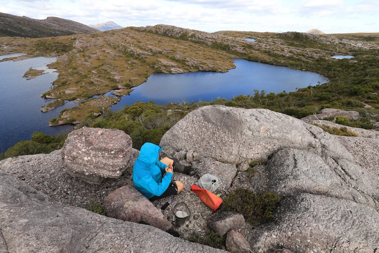
As there were no real tracks on the plateau we headed to Symphony Lake taking open grassy leads where possible. There were sections of footpad; worn bits that lasted a few metres then disappeared as mysteriously as they appeared. Craig, our master route finder, weaved through the undergrowth and gullies and picked his way across boulders. We fanned out to avoid making a track. While he wandered ahead I stumbled along, turned one way then the next, backtracked, and stood for long moments trying to think my way through the next barrier of vegetation. Once down amongst the little creeks winding out of Symphony Lake we were back on easier footing, walking past stands of pine and fagus. We veered south, out to the edge for a look at the massive cliffs above Lake Huntley - they provide an epic scene of untouched country stretching eastwards to the Tasmanian Wilderness World Heritage Area in the distance. In a few years time, standing on that staggering cliff edge will be to look down on a small village. Further south we had lunch on the flat rock terraces overlooking Lakes Matthew, Mark and Malcolm. Stupendous view. Directly below will be the next iconic walk and yet another village.
Artist’s impression of the Lake Huntley accommodation hub
A comment from the PWS staff at the information session was that the level of development on this track, in terms of engineered surfaces and widths, will be less than the Three Capes Track but more than the Overland Track. The contractor responsible for interpretation talked about keeping things minimal, subtle, natural. There is talk of an app and QR codes rather than sculptural installations such as on the Three Capes.
Camped beside Lake Tyndall on our 2020 trip, I woke on day two and once again had my cuppa in bed, tent door open and the sun breaking over the eastern clouds. There was lovely light across the plateau, not a track in sight, no buildings, huts, camping platforms, boardwalks or helipads (let’s not forget the helipads, and the sound of helicopters servicing these tracks). A few small birds and rosellas were calling in the distance. In Lake Tyndall a platypus surfaced and its wet fur reflected the morning light like it was a silver jewel moving across the dark water.
I am grateful the track has been re-routed to the east of the plateau. At the information session, however, I was asked how I felt about the project. I couldn’t bring myself to respond enthusiastically. Many good arguments were presented - particularly the tourism benefits for Tasmania’s West Coast with the walk rounding out its growing arsenal of wilderness experiences including the wilderness railway, the Gordon River Cruise, and new mountain bike trails. My concern was, and is, a wider one - an unease with why we feel the need to develop everything for everyone. Can the mountains not just stay as they are: wild, untouched, beautiful.
“The first issue that appears when we get into this matter , the most important issue and perhaps the only issue, is the one called accessibility. The Developers insist that the parks must be made fully accessible…” wrote Edward Abbey back in 1968. “What does accessibility mean? Is there any spot on earth that men have not proved accessible by the simplest means - feet and legs and heart?”
At the information session in Hobart I had a casual conversation with one of the project contractors. We discussed the Three Capes Track and she spoke strongly in favour of how it provides a hiking experience for people who may not have the confidence or experience to tackle less accessible areas. I tried to respond by arguing that people should embrace the challenge, joys and immense rewards of gaining that confidence and experience. With time, people can learn how to tackle anything they want, anywhere. (Neither of us, I am sure, were talking about accessibility in terms of people with disabilities who have a physical barrier to walking into wild places.)
While these kind of engineered tracks provide an easy, multi-day hiking experience with few obstacles, the tracks and huts also insulate people from the immersive, sensory, physical experience one expects from a bushwalk. And, the challenges and rewards that come with that. Wild, remote places like the Tyndalls are not inaccessible at all, they are just hard and that’s okay.
“All things excellent are as difficult as they are rare, said a wise man. If so, what happens to excellence when we eliminate the difficulty and the rarity?” wrote Edward Abbey.
If you want a lesson in the evils of 'Industrial Tourism' then read, or re-read, Abbey. To find out more about the iconic walk then stay tuned here, or visit the TNPA at www.tnpa.org.au. Other vocal organisations in this process include the Bob Brown Foundation and it was largely due to their campaigning that the track route was moved off the sensitive plateau. Wild magazine also has two fantastic articles on commercialisation in National Parks in Australia and these are available online, free. Mountain Journal also has a series of articles tracing the history of the Iconic Walk development. You can follow PWS Tasmania’s information here. Tasmanian newspapers The Mercury and The Examiner both featured stories last week on the iconic walk information sessions if you wish to track those down.
In the interest of transparency, this piece is written as a personal response to all that I have read on the next iconic walk. Please note that I did not seek official comment from PWS nor did I seek to officially interview anyone in regard to this walk. Take my views, or not. I just felt compelled to speak. I still feel compelled to be cautious. Even more compelled to question intent and outcomes.
Work on the new ‘iconic walk’ will commence in 2025 with the track planned for opening in 2029. There will be future points in the planning and development process where public comments will be sought. Certainly the feeling I got at the information session last week is that PWS are keen to be seen as transparent and open to public comments but that the time for opposition has passed. They plan to go ahead with the walk no matter the feedback.
Anyway, it’s time to stop writing. And reading. It’s time for me (and you) to dress for the mountain ahead, drive to some obscure little footpad off the side of a dirt road and battle through those determined trees and that tough scrub to find and enjoy and cherish and love the last of the untouched, the undeveloped wild places.


